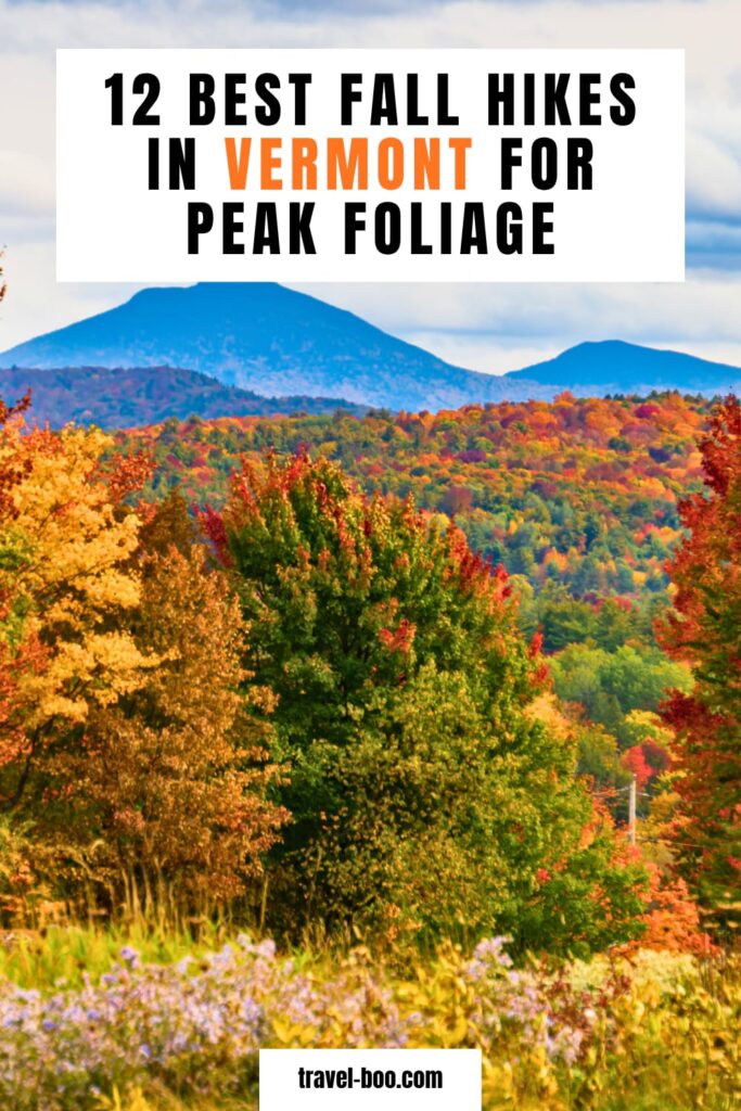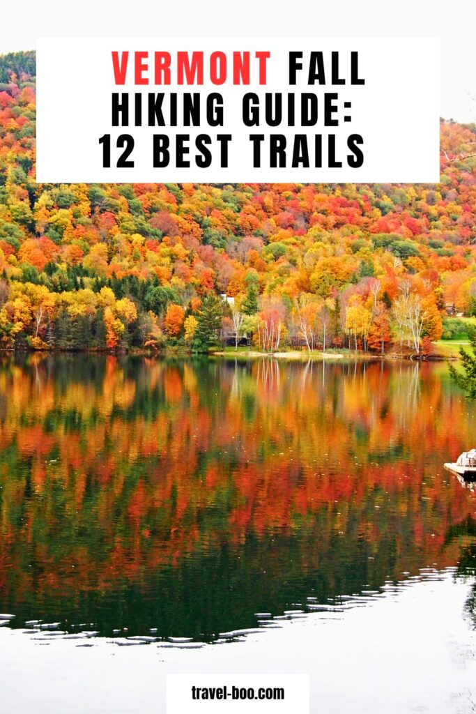
12 Best Fall Hikes in Vermont for Peak Foliage (2026 Updated!)
Vermont packs more good foliage hiking into a small area than anywhere else in the country. You can climb a 4,000-foot alpine ridge in the morning and walk up a 968-foot roadside summit for sunset, and both will be at peak on the same day in early October.
The catch is that peak moves fast here. Color starts in the Northeast Kingdom in late September and works south and downhill over about three weeks, so a trail that is spectacular on October 2 can be bare by the 20th. Picking the right trail matters as much as picking the right weekend.
These are the twelve best fall hikes in Vermont, ordered by how good the payoff is rather than how easy the drive is, with real mileage, real elevation gain, and the trailhead details that decide whether you get a parking space.
This post contains affiliate links. As an Amazon Associate, I earn from qualifying purchases. If you book or buy through these links, I may earn a small commission at no extra cost to you. This helps support Avid Campers and allows me to keep creating free outdoor content.
When Vermont Actually Peaks
Vermont splits into four foliage regions and they do not peak together. If your dates are fixed, this is how you choose which end of the state to drive to.
- Northeast Kingdom: turns first, usually in the last week of September. Quietest part of the state and the most consistently underrated.
- Northern Vermont (Stowe, Mount Mansfield, the Champlain Valley): late September into the first week of October.
- Central Vermont (Killington, Woodstock, the Mad River Valley): early to mid-October.
- Southern Vermont (Manchester, Bromley, Mount Snow): mid to late October, roughly two weeks behind the Kingdom.
Elevation runs on top of that. Summits above 3,000 feet turn a week or more before the valleys below them, so a hike that looks past peak from the road can still be holding color halfway up. Forecasters put Vermont’s 2026 statewide peak at around October 9, though weather in September will move that in either direction. For how this fits into the wider season, the best time to see fall colors in each US region covers where else is peaking the same week.
The 12 Hikes at a Glance
| Hike | Region | Distance | Elevation gain | Difficulty |
|---|---|---|---|---|
| 1. Camel’s Hump via Burrows Trail | Huntington | 4.7 mi round trip | 2,260 ft | Hard |
| 2. Mount Pisgah, South Trail | Westmore, NEK | ~4.5 mi round trip | ~1,500 ft | Moderate |
| 3. Mount Mansfield via Sunset Ridge | Underhill | 5.4 mi round trip | 2,545 ft | Hard |
| 4. Stowe Pinnacle | Stowe | 3.5 mi round trip | 1,520 ft | Moderate |
| 5. Mount Hunger, Waterbury Trail | Waterbury | ~4 mi round trip | ~2,275 ft | Hard |
| 6. Mount Elmore | Morrisville | 4.2 mi loop | 1,470 ft | Moderate |
| 7. Snake Mountain | Addison | 5.4 mi loop | 1,060 ft | Moderate |
| 8. Belvidere Mountain | Lowell | 7.9 mi loop | 1,980 ft | Challenging |
| 9. Laraway Lookout | Waterville | 3.6 mi out and back | 1,390 ft | Moderate |
| 10. Mount Philo | North Ferrisburgh | 2 mi round trip | 600 ft | Moderate |
| 11. Great Cliff of Mount Horrid | Rochester | 1.4 mi round trip | 650 ft | Short and steep |
| 12. Bromley Mountain | Peru | 6 mi round trip | 1,420 ft | Moderate |
1. Camel’s Hump via the Burrows Trail
4.7 miles round trip | 2,260 feet of gain | Hard | Huntington | Peak: late September to early October
Camel’s Hump is the best foliage hike in Vermont and it is not especially close. At 4,083 feet it is the state’s third-highest peak and its most recognizable, with a bare rocky summit that gives you a genuine 360-degree view: the Champlain Valley and the Adirondacks to the west, the White Mountains east, and rows of Green Mountains running north and south. In the first week of October you are looking down on all of it in color.
The Burrows Trail is the shortest way up. It starts gently for about a mile, then steepens into rooty, rocky ledges, thinning out as you climb until you reach the Hut Clearing at 2.1 miles. From there you pick up the Long Trail’s white blazes for the final 0.3 miles above treeline. Allow four to five hours with time at the top.
That last stretch crosses a fragile alpine zone, where thin soils and brutal winds support sedges, lichens and tiny arctic plants that are rare in New England and are easily killed underfoot. Stay on the marked route and on rock. Dogs are welcome but have to be leashed from the Hut Clearing up. If you want a longer day, the counterclockwise loop via the Forest City Trail and the Long Trail is 5.8 miles and takes in the better views on the approach from the south.
💡 Insider Tip: There are two parking areas on Camel’s Hump Road and the upper Forest City / Burrows lot is 0.7 miles past the lower one. If the upper lot is full, drive back down and use the lower lot rather than squeezing onto the road: it is narrow, and the Green Mountain Club specifically asks hikers not to park along it. The extra 0.7 miles each way is a small price compared with blocking an emergency vehicle on the busiest hiking weekend of the year.
2. Mount Pisgah via the South Trail
About 4.5 miles round trip | Roughly 1,500 feet of gain | Moderate | Westmore | Peak: last week of September
The most dramatic setting on this list. Mount Pisgah forms the eastern wall of Willoughby Gap, and its cliffs drop straight into Lake Willoughby, one of the deepest lakes in New England and the reason people keep comparing this corner of the Northeast Kingdom to a Norwegian fjord. The lookouts are directly above the water, which means you are looking down at color rather than across at it.
Start from the pull-off on Route 5A south of the lake, cross the boardwalk over the wetland, and climb steadily through hardwoods. About a mile up you reach Pulpit Rock, an overhang roughly 650 feet above the lake and the view most people come for. The trail then swings away from the cliffs to the wooded summit and the North Overlook, which is more open and feels safer if you are hiking with children.
The Northeast Kingdom is the first part of Vermont to turn, usually in the last days of September, which makes this the right choice if your dates land earlier than everyone else’s. The parking is a small gravel pull-off and it fills on foliage weekends. If you want a longer, more gradual approach, the Long Pond Trail comes in from the east at about 5.4 miles with roughly 1,100 feet of gain.
3. Mount Mansfield via the Sunset Ridge Trail
5.4 miles round trip | 2,545 feet of gain | Hard | Underhill State Park | Peak: late September to early October
Vermont’s highest summit, taken by its best route. Sunset Ridge climbs out of the forest early and then runs along an open rocky ridge with the Champlain Valley and the Adirondacks laid out to the west for the whole upper half of the hike. Most trails give you a view at the end. This one gives you a view for an hour.
The route starts from Underhill State Park at about 2,000 feet on the western flank of the mountain, inside the 39,837-acre Mount Mansfield State Forest. Follow the Eagles Cut Trail to the CCC Road, pick up Sunset Ridge at the signed junction, and finish north on the Long Trail to the Chin. Allow four and a half to five hours. The upper section is exposed with no shelter from wind, and October weather on the summit ridge bears very little relation to the forecast in Burlington.
The summit ridge holds alpine tundra vegetation that is genuinely rare in New England and closer to what grows in the Arctic. It survives on thin soil and does not recover from being walked on, so stay on the marked trail and on bare rock the entire way. Parking is limited enough that Vermont State Parks recommends carpooling, and at busy times you may have to park along Mountain Road below the park entrance.
💡 Insider Tip: Underhill State Park is open from the Friday of Memorial Day weekend through the second Monday in October, which in 2026 is October 12. That is right in the middle of peak color. After the park closes, the gate is shut and the trailhead is still reachable, but you park in the plowed area and walk the road, roughly a mile each way, adding about two miles to your day. If you are hiking Mansfield in the second half of October, budget for it.
4. Stowe Pinnacle
3.5 miles round trip | 1,520 feet of gain | Moderate | Stowe | Peak: late September to early October
The best return on effort in northern Vermont. Stowe Pinnacle is a 2,640-foot bald rock summit in the Worcester Range with a full panorama: Mount Mansfield looming to the northwest, Mount Hunger to the south, Camel’s Hump and the rest of the Greens on a clear day, and the Stowe valley directly below in color.
The trail crosses open meadow and warms up on an easy grade for about half a mile before turning into a steep, staircase-like climb through mixed hardwood. There is an overlook spur about halfway with a view west to Mansfield. Near the top the forest thins and the trail levels out before the final scramble onto the summit rock, which is broad enough to spread out on for a picnic.
Set expectations on crowds: this is a short trail with a huge view in a busy resort town, and it is one of the most-hiked paths in Vermont. You will not have it to yourself on an October Saturday. If you want more from the day, the Ridge Trail continues to Hogback Mountain and on to the Skyline Trail, which links across to Mount Hunger and Mount Worcester.
💡 Insider Tip: Vermont’s official Trail Finder flags both Stowe Pinnacle and Camel’s Hump as high-use trail systems, busiest between 9am and 4pm on weekends, and asks hikers plainly to choose a different trail if the lot is full rather than parking creatively. Take that seriously in October. Mount Elmore and Laraway Lookout, both on this list, are 30 to 40 minutes away and are the intended answer.
5. Mount Hunger via the Waterbury Trail
About 4 miles round trip | Roughly 2,275 feet of gain | Hard | Waterbury | Peak: late September to early October
Short mileage, serious climb. Mount Hunger is 3,539 feet and the Waterbury Trail gains most of that in under two miles, with almost no flat ground anywhere on it. What you get at the top is a bald open summit with views to the east, south and west that take in Camel’s Hump, Mount Mansfield, Killington, Whiteface, the Adirondacks and, on a clear day, the White Mountains. Plenty of Vermont hikers rate the foliage view from here as the equal of anything on the 4,000-footers.
There is a small waterfall partway up that makes a natural rest stop. The last stretch turns to open rock and requires hauling yourself up with your hands in places, which is scrambling rather than hiking. Wet rock makes it considerably harder, and the descent is where people get into trouble, so trekking poles are worth having for the way down even if you do not use them going up.
The Waterbury Trail trailhead is a small dirt lot reached by back roads from either Waterbury or Stowe, and it fills early on weekends. The summit connects to the Skyline Trail, which links Hunger to Stowe Pinnacle and Mount Worcester across C.C. Putnam State Forest if you want to build a much bigger day.
6. Mount Elmore
4.2 mile loop | 1,470 feet of gain | Moderate | Morrisville | Peak: late September to early October
The best beginner-friendly mountain hike in northern Vermont and the answer when Stowe Pinnacle is full. Mount Elmore is one of the smaller peaks in the Worcester Range, and the fire tower on the summit gives you the elevation the mountain itself does not, with the Worcester Range in one direction and the Green Mountains in the other.
The 4.2-mile loop takes about three hours at an unhurried pace and is a genuinely good introduction to Vermont hiking: enough climbing to feel like a mountain, not enough to be intimidating. It sits inside Elmore State Park, so the standard Vermont state park day-use fee applies during the season.
Climbing a fire tower with children needs a bit of judgement. The steps are open and exposed, and in October the wind at the top of the tower is considerably stronger than at the base.
7. Snake Mountain
5.4 mile loop | 1,060 feet of gain | Moderate | Addison | Peak: early to mid-October
The best of the Champlain Valley hikes and a completely different kind of view from the mountain trails further east. Snake Mountain is one of the most prominent peaks in the area, and from the top you get the Champlain Valley spread out below with the Adirondacks across the water to the west and the Green Mountains standing up to the east.
What makes it work in autumn is the composition. Instead of looking at a wall of forest, you are looking across farmland, hedgerows and lake with two mountain ranges framing it, so the color reads as patchwork rather than a single mass. The Champlain Valley also peaks slightly later than the mountains, which makes this a solid pick for a mid-October weekend when Mansfield and Camel’s Hump have already gone over.
The grade is gentle by Vermont standards, with 1,060 feet spread across a long approach, which makes this one of the more manageable five-mile days on the list. If you have not done a hike this length recently, our guide to how long it takes to hike five miles covers how much elevation changes the arithmetic.
8. Belvidere Mountain
7.9 mile loop | 1,980 feet of gain | Challenging | Lowell | Peak: late September to early October
The biggest day on this list and the one with the widest view. Belvidere’s fire tower gives a clean 360 on a clear day: the Green Mountains running south all the way to Camel’s Hump, Jay Peak and Big Jay to the north, Owl’s Head and the Quebec hills near Lake Memphremagog beyond them, and the White Mountains east. Very few Vermont summits show you three states and a foreign country at once.
The full loop runs the Frank Post Trail to the Long Trail to the Forester’s Trail, in either direction, at 7.9 miles and about five and a half hours. There is a shorter option: park at the Long Trail State Forest lot on Route 118 in Eden and take the Long Trail north 2.6 miles, then a 0.1-mile spur east to the tower, for 5.4 miles round trip. That lot is small, and if it is full there is an alternative start where the Long Trail crosses Route 118, which makes a 4.8-mile out and back.
This is the quietest big hike on the list. It is far enough north and far enough from Stowe that it never gets the traffic Camel’s Hump does, and in the last week of September the northern color is fully in.
9. Laraway Lookout
3.6 miles out and back | 1,390 feet of gain | Moderate | Waterville | Peak: late September to early October
A short section of the Long Trail that punches well above its length. From Codding Hollow Road you head north on the Long Trail for 1.8 miles to a lookout with views across to Mount Mansfield and the Sterling Range, both of which are worth seeing in color from a distance rather than from on top of them.
The distinguishing feature on the way up is a series of overhanging rock ledges that the trail passes directly beneath, which is unusual in Vermont and makes the approach more interesting than the mileage suggests. Around two and a half hours round trip.
This is the other trail to redirect to when the Stowe-area lots are full. It is about 40 minutes from Stowe and sees a fraction of the traffic.
10. Mount Philo
2 miles round trip | 600 feet of gain | Moderate | North Ferrisburgh | Peak: early to mid-October
The easiest big view in Vermont. Mount Philo is only 968 feet, but it stands alone at the edge of the Champlain Valley, so the summit gives you the whole valley, the lake, and the Adirondacks behind it with nothing in the way. It became the first Vermont state park in 1924, and the 237-acre park has a paved road to the top as well as the trail.
The trail is short and climbs the entire way, which catches people out who assume two miles means easy. It is still the most family-viable summit on this list, and the road option means you can drive one group up and walk the other.
One practical detail that makes Philo the best sunrise option in the state: it opens at 8am, while the other Vermont state parks open at 10am. In mid-October that is the difference between arriving for early light and arriving after the valley haze has burned off. The entrance and camp roads are not recommended for trailers, and buses and limos have to stay in the lower lot.
11. The Great Cliff of Mount Horrid
1.4 miles round trip | 650 feet of gain | Short and steep | Rochester | Peak: early to mid-October
The shortest hike here and, per mile, the best value. From Brandon Gap you follow the Long Trail north for 0.7 miles, then take a 0.1-mile spur at the top of a rock staircase to a cliff-top opening with big views south and east over the central Green Mountains. It is steep and demanding for its length, but it is done inside an hour and a half.
This one belongs on a central Vermont driving day rather than as a destination in itself. Brandon Gap sits on Route 73 between Brandon and Rochester on a road that is a foliage drive in its own right, so the hike works as the leg-stretch in the middle of it.
💡 Insider Tip: The cliff is closed from March 15 to August 1 every year to protect nesting peregrine falcons, which is exactly why autumn is the right time to hike it. The same applies at Mount Pisgah, where the Lake Willoughby cliffs carry one of Vermont’s most active peregrine sites and are subject to seasonal closures in spring and early summer. Both are fully open by foliage season, and both are worth doing then partly because you cannot do them in June.
12. Bromley Mountain
6 miles round trip | 1,420 feet of gain | Moderate | Peru | Peak: mid to late October
The southern Vermont pick, and the reason it earns a place is timing. Southern Vermont peaks roughly two weeks behind the Northeast Kingdom, so when Camel’s Hump and Mansfield are bare, Bromley is arriving. If your foliage trip falls in the third week of October, drive south rather than assuming you have missed the season.
From the Route 11/30 parking lot, the Long Trail heads north on a steady, gradual climb over about three miles, crossing Bromley Brook and passing Bromley Shelter on the way to the summit. The fire tower at the top gives sweeping views in most directions. The Bromley Ski Patrol hut at the summit is open for hikers to use in summer and autumn, which is a genuine comfort on a cold, windy October afternoon.
The gradient is friendly for the distance, which makes this the most approachable six-mile day on the list and a good option for a group with mixed fitness.
Before You Go
A handful of Vermont-specific things that decide how well the day goes.
Park fees. Day-use admission at Vermont state parks is $5 for adults aged 14 and over, $2 for children aged 4 to 13, and free for under-fours. That applies at Underhill, Elmore and Mount Philo on this list. The trailheads in state forests and on the Long Trail, including Camel’s Hump, Mount Hunger, Belvidere, Laraway and Mount Horrid, are free.
Season dates. Vermont state parks run roughly May to October, and several close right in the middle of peak color. Underhill closes the second Monday in October. Lincoln Gap, which gives access to Sunset Ledge and several Long Trail sections, closes on October 15, after which you add a mile of road walking from the gate. The Smugglers’ Notch section of Route 108 closes to vehicles for the winter each year on a weather-dependent date, so check before planning a route through the Notch in late October.
Alpine zones. Camel’s Hump, the Mount Mansfield ridge and Mount Abraham hold rare arctic-alpine plant communities on thin soil. Stay on marked trail and bare rock above treeline, keep dogs leashed there, and do not step off for a photograph. These plants take decades to recover.
Dogs. Vermont is generally dog-friendly on trail. Underhill State Park allows pets throughout, and dogs are welcome on Camel’s Hump provided they are leashed from the Hut Clearing upward through the alpine zone. Mount Pisgah is dog-friendly, though the cliff-edge overlooks call for a short lead.
Weather. October on an exposed Vermont summit is not October in the valley. Summit forecasts run considerably colder and windier than town forecasts, and the alpine ridges offer no shelter at all. Check a mountain-specific forecast rather than the one for the nearest town.
💡 Insider Tip: If you are doing more than four state park trailheads in a season, buy the Vermont State Parks 10-punch card. It costs $40, one punch covers day-use entry for one person, and it never expires, so the punches you do not use this October are still good next autumn. The individual season pass is also $40 but expires, and a vehicle pass is $105. For a foliage long weekend hitting Underhill, Elmore and Mount Philo with two people, the punch card is the one that makes sense.
What to Pack
Two things go wrong on Vermont foliage hikes more than anything else: people underestimate the summit wind, and they underestimate how early the light goes in mid-October.
- A wind shell and a warm layer. Non-negotiable on Camel’s Hump, Mansfield and Mount Hunger, where the summits are open rock with no cover.
- A headlamp. Sunset in central Vermont in mid-October is well before 6pm, and the Burrows and Waterbury trails are rooty and rocky enough to be slow in the dark.
- Trekking poles. Worth more on the descent than the climb, particularly on Mount Hunger and Harmon Hill-style steep sections.
- Grippy footwear. Wet leaves on rock slab are the most underrated hazard of the whole season.
Vermont Foliage Hiking Kit
A wind shell, a warm hat, a headlamp and poles cover almost everything that goes wrong on an October day in the Green Mountains. None of it is expensive and all of it fits in a small day pack.
If your boots have not been out since spring, it is worth reading how hiking boots should fit before taking on the Sunset Ridge descent. Steep, sustained downhill on wet leaves is what turns a slightly loose heel into a blister at mile four.
Check these hiking essentials before your trip (paid links):
- A hiking day backpack
- Comfy pair of men’s boots, or woman’s hiking boots
- Hiking water bottle for hydration
- A cozy men’s and woman’s raincoat / windbreaker for those gusty summits
- A set of hiking poles
Where to Stay
Three bases, one per foliage window, so you can match your lodging to when you can actually travel:
- Stowe for the northern peaks. Mansfield, Stowe Pinnacle, Mount Hunger and Elmore are all within 40 minutes, and peak is usually late September into the first week of October.
- Burlington for the Champlain Valley and a shorter drive to Camel’s Hump, Mount Philo and Snake Mountain. Peaks slightly later than the mountains and has far more lodging stock.
- Lake Willoughby or Burke for the Northeast Kingdom. This is the late-September option, and it is where you go if you want quiet.
Find a Base for Peak Week
Vermont foliage lodging books out months ahead and prices climb steeply through September, particularly in Stowe. Comparing across booking sites in one search is the quickest way to see what is genuinely left for your dates.
Compare stays in Stowe, Burlington and Lake Willoughby
Building the Weekend
The pattern that works best here is one big summit and one short one per day, rather than two long climbs. Camel’s Hump in the morning and Mount Philo for late light is a genuinely good Saturday. Mount Pisgah and a drive around the Kingdom is a good Sunday. Stowe Pinnacle plus Elmore fills a day without wrecking anyone.
And if your dates slip past Vermont’s window entirely, you have not missed autumn. The Blue Ridge peaks two to three weeks later, and the best hikes in Boone NC give you a similar mix of open summits and long ridge views in the second half of October. For the bigger picture, the 9 most stunning national parks for fall colors covers which parks are peaking when, and the best national parks on the East Coast is the natural next trip if Vermont gets you hooked.
Frequently Asked Questions
When is peak foliage in Vermont?
It moves north to south over about three weeks. The Northeast Kingdom turns first, usually in the last week of September. Northern Vermont around Stowe and Mount Mansfield follows in late September into the first week of October. Central Vermont peaks early to mid-October, and southern Vermont around Manchester and Bromley is typically mid to late October. Higher summits turn a week or more before the valleys below them.
What is the best fall hike in Vermont for beginners?
Mount Philo, at 2 miles round trip and 600 feet of gain, gives you a full Champlain Valley and Adirondack view for very little effort, and there is a paved road to the summit if part of your group would rather drive. For something that feels more like a mountain, Mount Elmore is a 4.2-mile loop with a fire tower at the top and no exposure.
Do you have to pay to hike in Vermont?
Only at state parks. Day-use admission is $5 for adults 14 and over and $2 for children 4 to 13, which applies at Underhill, Elmore and Mount Philo. Trailheads in state forests and on the Long Trail, including Camel’s Hump, Mount Hunger, Belvidere and Mount Horrid, are free. If you are visiting several parks, a $40 ten-punch card works out cheaper and never expires.
Can I bring my dog on Vermont fall hikes?
Generally yes. Underhill State Park permits pets throughout, and dogs are welcome on Camel’s Hump as long as they are leashed from the Hut Clearing upward, because the summit sits in a fragile alpine zone. Mount Pisgah is dog-friendly too, though a short lead is sensible around the cliff-edge overlooks above Lake Willoughby.
Is Camel’s Hump or Mount Mansfield better for fall foliage?
Camel’s Hump, narrowly. Both give you an open alpine summit and a 360-degree view, and both peak at the same time, but Camel’s Hump is shorter at 4.7 miles against 5.4, its summit is undeveloped, and the Burrows Trail is the more straightforward climb. Mansfield’s advantage is the Sunset Ridge itself, which gives you an hour of open ridge views rather than a view only at the top. If you can only do one, do Camel’s Hump. If you can do both, do Mansfield second.
What should I wear hiking in Vermont in October?
Layers, with a windproof outer shell you can put on at treeline. Summit conditions on Camel’s Hump, Mansfield and Mount Hunger are considerably colder and windier than the valley forecast, and those summits are open rock with no shelter. Grippy footwear matters too, because wet leaves over rock slab are the most common cause of falls in foliage season. Carry a headlamp regardless of your start time.