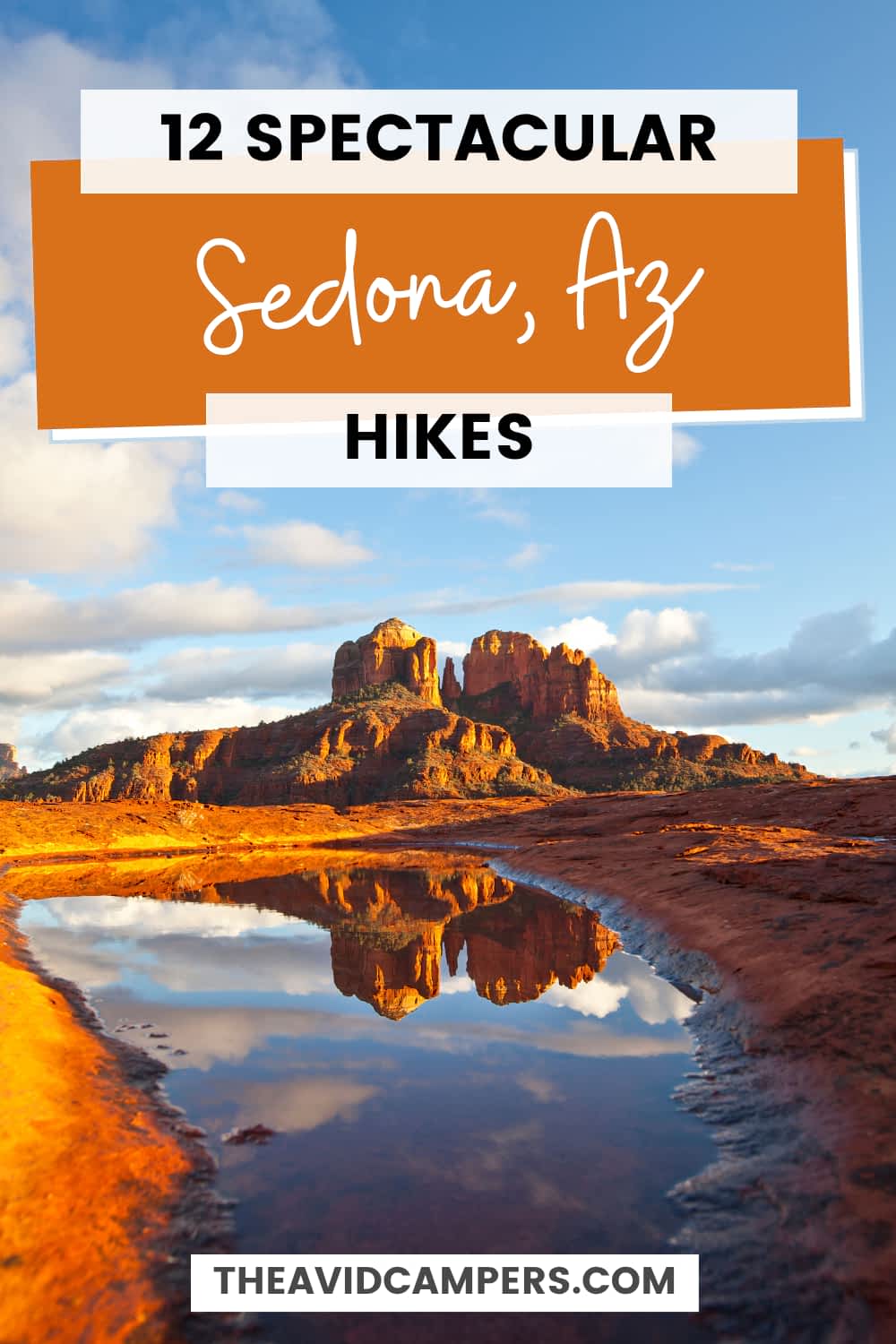

12 Stunning & Best Hikes in Sedona, Arizona (2026 Guide)
Sedona sits in a bowl of red Permian sandstone about 30 miles south of Flagstaff, and almost every trail here climbs, skirts or tunnels through it. That is the appeal. You do not need a full day or serious mileage to end up somewhere genuinely spectacular, because on most of these trails the payoff arrives inside the first mile.
What has changed is getting to the trailhead. Sedona now runs a free shuttle to five of its busiest trailheads, and private vehicles are locked out of two of those parking lots entirely while the shuttle is running. Sort that out before you leave your hotel and the rest is easy.
These are the twelve best hikes in Sedona, ordered by what you get back for the effort, with current mileage, elevation gain and trailhead access for each one.
This post contains affiliate links. As an Amazon Associate, I earn from qualifying purchases. If you book or buy through these links, I may earn a small commission at no extra cost to you. This helps support Avid Campers and allows me to keep creating free outdoor content.
Before You Hike: Shuttles, Passes and Closures
Three things decide whether your morning goes smoothly in Sedona, and none of them are on the trail.
The Sedona Shuttle
The City of Sedona runs free Trailhead Routes year-round, Thursday through Sunday, roughly 7am to 5:30pm, with daily service during spring break and some holidays. No reservations. The buses run from three free park and ride lots to five trailheads: Cathedral Rock, Little Horse, Soldier Pass, Dry Creek Vista and Mescal.
The part people miss: the Forest Service parking lots at Cathedral Rock and Soldier Pass are closed to the general public whenever the shuttle is operating. Not full, closed. If you drive out there on a Saturday morning you will be turned around. Little Horse, Dry Creek Vista and Mescal all stay open to cars, so Devil’s Bridge, Chicken Point and the Birthing Cave are still drivable on shuttle days.
One thing that softens the blow: shuttle riders are not charged a parking fee at the trailhead, so if you are only hiking Cathedral Rock or Soldier Pass on a shuttle day, you do not need a Red Rock Pass at all.
The Red Rock Pass
Most Forest Service trailhead lots around Sedona are fee sites. A Red Rock Pass runs $5 daily, $15 weekly or $20 annually, and an America the Beautiful pass works in its place at nearly all of them. Buy at trailhead kiosks, the Sedona Chamber visitor center or online through Recreation.gov. A handful of concessionaire-run day use sites, including Call of the Canyon at the West Fork trailhead, do not accept either pass and charge their own daily fee instead.
Note that the Forest Service has proposed raising recreation fees across the Coconino, so check the current rate at the kiosk rather than assuming.
Post-fire closures
The Pocket Fire burned 27,393 acres north of Sedona in summer 2026 and was declared 100% contained on July 30. Most trails reopened the following day, but a handful stayed shut because burned watersheds are prone to flash flooding and debris flows during monsoon storms. West Fork Trail #108 and the Call of the Canyon day use site remain closed, along with Bear Sign, Dry Creek, HS Canyon, Secret Canyon and David Miller trails.
Closure orders change. Check the Coconino National Forest alerts page and the Sedona Shuttle site the night before you hike.
When to go
March through May and September through November are the good months, and they are also the crowded ones. Summer is genuinely dangerous on the exposed trails here, where midday temperatures regularly pass 100°F and there is no shade on Cathedral Rock, Bear Mountain or the Airport Loop. Winter is underrated: cold mornings, thin crowds, and occasional snow dusting the red rock, which photographs beautifully.
The 12 Best Hikes in Sedona at a Glance
| Hike | Distance | Elevation gain | Difficulty |
|---|---|---|---|
| Cathedral Rock | 1.1 mi out and back | 669 ft | Strenuous |
| Devil’s Bridge | 1.6 mi from 4×4 trailhead, approx. 4 mi from Dry Creek Vista | 371 ft | Moderate |
| Soldier Pass | 4 mi out and back | 641 ft | Moderate |
| Boynton Canyon | 6 mi out and back | 931 ft | Moderately challenging |
| Bell Rock and Courthouse Butte Loop | 3.8 mi loop | 297 ft | Moderate |
| Little Horse to Chicken Point | 3 mi out and back | 330 ft | Moderately easy |
| Birthing Cave | approx. 2 mi out and back | approx. 250 ft | Easy, with a steep finish |
| Airport Loop | 3.3 mi loop | Rolling | Easy to moderate |
| Fay Canyon | 2.1 mi out and back | 144 ft | Easy |
| Doe Mountain | 1.4 mi out and back, plus 1.3 mi rim loop | 542 ft | Moderately challenging |
| Bear Mountain | 4.6 mi out and back | approx. 2,100 ft | Strenuous |
| West Fork | approx. 6.9 mi out and back | Slight | Moderate (currently closed) |
Distances and elevation figures are the Coconino National Forest’s own numbers where the agency publishes them.
1. Cathedral Rock Trail

Distance: 1.1 miles out and back | Elevation gain: 669 ft | Difficulty: Strenuous | Location: Coconino National Forest, Red Rock Ranger District
Nothing else in Sedona gives you this much for a mile of walking. The Forest Service calls Cathedral Rock more of a rock climb than a hike, and that is fair: after a gentle quarter mile across the wash you are following basket cairns up bald sandstone, using your hands through a shallow cleft with toeholds notched into the rock. It ends in the saddle between two spires, looking out over the Verde Valley.
Be honest with yourself about the scramble. It is short but genuinely steep, the rock is polished slick by traffic, and coming down is harder than going up. Shoes with real grip make the difference here more than on any other trail in this guide.
The trailhead is on Back O’ Beyond Road, 3.5 miles south of the 89A and 179 junction, then 0.6 miles in. A Red Rock Pass or America the Beautiful pass is required to park.
💡 Insider Tip
Do not drive to the Cathedral Rock trailhead on a Thursday, Friday, Saturday or Sunday. The Forest Service closes the lot to the public for as long as the Sedona Shuttle is operating, and the access road is restricted to resident traffic. Park free at the North SR-179 Park and Ride instead and take Route 15, which also serves Little Horse. The lot reopens once the shuttles go out of service for the day.
2. Devil’s Bridge Trail

Distance: 1.6 miles out and back from the Devil’s Bridge trailhead, roughly 4 miles from Dry Creek Vista or Mescal | Elevation gain: 371 ft | Difficulty: Moderate | Location: Coconino National Forest
The largest natural sandstone arch in the Sedona area, and the most photographed thing in Arizona outside the Grand Canyon. The walking is easy until the final stretch, where a stone staircase and a short scramble put you on top of the span.
The mileage depends entirely on where you park, which is what confuses people. The official Devil’s Bridge trailhead sits 1.3 miles up rough Forest Road 152 and needs a high-clearance vehicle. From there it is 1.6 miles round trip. Everyone else parks at Dry Creek Vista and walks in via the Chuckwagon Trail, or at Mescal, which makes it closer to four miles.
An honest word about the queue: on a spring weekend the line to stand on the arch for a photo can run 45 minutes or more. If that is the whole reason you came, go at sunrise or skip it. The trail itself is pleasant but not remarkable, and the bridge is the point.
Dry Creek Vista and Mescal are both Sedona Shuttle stops on Route 11 from the West SR-89A Park and Ride, and unlike Cathedral Rock and Soldier Pass, you can still drive and park at both.
3. Soldier Pass Trail

Distance: 4 miles out and back | Elevation gain: 641 ft | Difficulty: Moderate | Location: Coconino National Forest into Red Rock-Secret Mountain Wilderness
The best value hike in Sedona if you want several distinct things in one outing. A quarter mile in you reach Devil’s Kitchen, an active sinkhole with a slab of sandstone balanced on its lip. Another quarter mile brings the Seven Sacred Pools, a chain of tinajas carved into the sandstone by runoff. Worth knowing before you build your day around them: the stream that fills the pools is seasonal, so outside the wet months they can be little more than damp hollows.
The real highlight is Soldier Pass Cave, reached by an unsigned spur that climbs steeply off the main trail. Getting inside means a scramble up a rockfall, and the framed view back down the canyon from the cave mouth is the shot everyone comes for.
You can turn around at the cave or continue and loop back via Brins Mesa, Cibola Pass and the Jordan Trail, which makes it a longer half-day. The first 1.3 miles run alongside a jeep road, so expect tour traffic and noise early on.
💡 Insider Tip
Soldier Pass has two access rules that catch people out. First, the Forest Service gate at the trailhead is locked between 6pm and 8am every day of the year, shuttle or no shuttle, so a sunrise start here is not an option. Second, the Forest Service caps the shuttle’s Route 14 at 300 passengers per day as a condition of the city’s special use permit, which is why buses run less often on this route than the others. Ride early in the day rather than turning up at 2pm and hoping.
4. Boynton Canyon Trail

Distance: 6 miles out and back | Elevation gain: 931 ft | Difficulty: Moderately challenging | Location: Red Rock-Secret Mountain Wilderness
Most Sedona trails are short sprints to a landmark. Boynton Canyon is a proper walk into a box canyon, and it changes character as you go: exposed red rock and desert scrub at the mouth, then increasingly forested and shaded as the canyon narrows, which is a relief that no other hike on this list offers in warm weather.
The trail skirts the Enchantment Resort for the first stretch, which is less scenic than what follows, so do not judge it early. Near the start, a short spur climbs the Boynton Vista Trail to the Kachina Woman formation, one of Sedona’s named vortex sites and worth the twenty minutes. At the far end, a steep final pitch leads to a viewpoint back across the canyon.
The other draw is Subway Cave, an eroded tunnel formation about two miles in. It is reached by an unmarked social trail with a Class 3 scramble at the end, and it sits beside Sinagua cliff dwellings. Those dwellings are protected archaeological sites and there is a well-documented history of visitors damaging them, so if you go, stay off the structures entirely and do not touch the rock art. If that sounds like more responsibility than you want, the main canyon trail is excellent on its own.
💡 Insider Tip
Leave the drone at home. Boynton Canyon, Fay Canyon and Bear Mountain all run into the Red Rock-Secret Mountain Wilderness, and Courthouse Butte Loop crosses the Munds Mountain Wilderness. Drones and bicycles are prohibited by federal law inside any designated Wilderness, not just discouraged, and the boundary is signed on the trail. On Soldier Pass, bikes are legal only for the first 1.3 miles up to that boundary.
5. Bell Rock and Courthouse Butte Loop

Distance: 3.8 mile loop | Elevation change: 297 ft | Difficulty: Moderate | Location: Munds Mountain Wilderness
The best introduction to Sedona if you want scenery without a scramble. The loop circles two of the area’s most recognizable formations, and because it is nearly flat, you spend the whole time looking up rather than watching your feet. Bell Rock, Courthouse Butte and the Mogollon Rim stay in view for most of it.
There are two trailheads. Courthouse Vista sits 5.2 miles south of the 89A and 179 junction; Bell Rock Vista is another 1.3 miles further south. Either works, and the loop goes equally well in both directions. Most people take it clockwise from Courthouse Vista.
You can also scramble a short way up Bell Rock itself on cairned routes off the loop. There is no summit as such, just a series of ledges that get progressively more exposed, so go up as far as you are comfortable and no further. The loop is almost entirely unshaded and gets hot from late morning onward.
6. Little Horse Trail to Chicken Point
Distance: 3 miles out and back | Elevation gain: 330 ft | Difficulty: Moderately easy, good for beginners | Location: Coconino National Forest, off SR-179
The most underrated hike on this list, and the best answer to a common Sedona problem: you want the big red rock panorama but you do not want to scramble up polished sandstone to get it. Little Horse climbs gently over slickrock benches to Chicken Point, a broad bare-rock saddle with the Two Nuns spire towering directly above it.
What you see from up there is most of the rest of this guide. Cathedral Rock to the west, Bell Rock and Courthouse Butte to the south, then Lee Mountain, Munds Mountain and Schnebly Hill running north to south when you face east. The Forest Service rates it moderately easy and good for beginners, and the trail is wide, well signed and easy to follow the whole way.
Two honest caveats. Chicken Point is a jeep tour destination via Broken Arrow Road, so you will almost certainly share it with a pink jeep or three, and it is not a quiet summit. And if you have already booked a jeep tour, that tour will take you to Chicken Point anyway, so hike something else instead.
The trailhead is 3.6 miles south of the 89A and 179 junction on the east side of the road. You can also extend east from the base of Chicken Point on the Jim Bryant Trail into the Wilderness, where bicycles are not allowed.
💡 Insider Tip
Do not treat Little Horse as your backup plan for Cathedral Rock. Both trailheads are served by the same shuttle route from the same park and ride, and the city states explicitly that Little Horse parking is not to be used as overflow for Cathedral Rock. The North SR-179 Park and Ride that feeds both holds only 65 vehicles, the smallest of the three lots, so on a busy spring weekend it is the park and ride itself that fills up first. Get there before mid-morning or ride Sedona Shuttle Connect to it.
7. Birthing Cave via Long Canyon Trail
Distance: approx. 2 miles out and back | Elevation gain: approx. 250 ft | Difficulty: Easy to the base, moderate to get inside | Location: West Sedona, off Long Canyon Trail No. 122
The quickest way in Sedona to reach somewhere that looks nothing like the parking lot you left. A flat, sandy walk through pinyon and juniper along the first stretch of the Long Canyon Trail, then a short climb to a curved alcove cut into the cliff face of a spur off Mescal Mountain.
The cave frames the valley beyond it, which is why it fills up with photographers. Climbing up the sloping sides inside the alcove is possible but the sandstone is polished and genuinely slippery, and people do fall. Sit at the back and take the picture from there if you are at all unsure.
Navigation is the one catch. The turnoff at roughly 0.6 miles is unmarked, there are competing social trails through this area, and there is no cell service. Download the route offline before you leave town.
💡 Insider Tip
The Long Canyon trailhead is one of the few popular Sedona access points that does not require a Red Rock Pass. It is a dirt pullout rather than a built lot, so it fills fast, but you can also park along the west side of Long Canyon Road. If it is genuinely full, the Mescal trailhead lot is just down the road and connects through.
8. Airport Loop Trail

Distance: 3.3 mile loop | Elevation: Rolling, no sustained climb | Difficulty: Easy to moderate | Location: Airport Mesa, West Sedona
A good hike to end a Sedona trip on, because it shows you everything you have already climbed. The loop circles Airport Mesa on its rim, and over 3.3 miles you get Cathedral Rock, Bell Rock, Courthouse Butte, Capitol Butte, Coffee Pot Rock, Munds Mesa and the town itself. Little elevation, but the terrain is rocky and there are exposed drops in places, so it is not a stroll.
Set expectations on one thing: a good stretch of the southwestern side runs beside the airport’s chain-link fence, directly under the runway. Some people find the plane-watching fun and some find it kills the mood. The northern half, with the views over West Sedona, is the better section if you only do part of it.
The nearby Airport Mesa Vortex is a two-tenths-of-a-mile scramble from the lower lot, and the Sedona View Trail connects the two parking areas in about 0.6 miles each way.
💡 Insider Tip
Your Red Rock Pass is worthless on Airport Mesa. The free Airport Saddle lot at the vortex holds roughly ten cars and is where the loop starts and ends, and the large Airport Mesa Scenic Overlook lot at the top of the road charges its own $3 day fee that neither the Red Rock Pass nor America the Beautiful covers. Budget the $3 separately, or arrive early enough for the free lot and walk the Sedona View Trail up to the overlook.
9. Fay Canyon Trail

Distance: 2.1 miles out and back | Elevation gain: 144 ft | Difficulty: Easy | Location: Red Rock-Secret Mountain Wilderness
The easiest genuinely scenic hike in Sedona, and the one to pick with small children or on a day when the heat rules out anything exposed. The trail runs along the floor of a short box canyon with red Supai sandstone walls rising on both sides, dead-ending at a cliff. There is enough desert vegetation in the basin to keep it noticeably cooler than the open trails.
One correction worth having before you go, because plenty of guides get it wrong: Fay Canyon Arch is not at the far end. The unsigned spur to it branches right roughly half a mile in from the trailhead, and the arch sits close against the canyon wall where it is hard to pick out from the main path. Miss the turn and you will walk the whole canyon wondering where it went.
The scramble up to the arch itself is steeper than the rest of the trail combined. Kids tend to love the boulders at the canyon’s end regardless.
10. Doe Mountain Trail
Distance: 0.7 miles to the mesa top, 1.4 miles out and back, plus a 1.3 mile rim loop | Elevation gain: 542 ft | Difficulty: Moderately challenging | Location: Coconino National Forest, off Boynton Pass Road
A flat-topped mesa you can summit in under half an hour, which makes it the best value climb in Sedona. The trail switchbacks up the north face and simply stops when the cap rock levels out, leaving you on a broad plateau roughly 400 feet above the surrounding country with nothing blocking the view in any direction.
From up there you can pick out Bear, Maroon and Wilson mountains, the mouths of Loy, Boynton and Secret canyons, Chimney Rock and the Cockscomb, with Sedona to the east and Sycamore Canyon and the Verde Valley off to the south. It is a genuine 360-degree panorama for 542 feet of climbing, which is a quarter of what Bear Mountain next door asks of you.
Do not stop at the top of the switchbacks. Most people take a photo and turn around, but walking the rim adds about 1.3 miles and is where the hike earns its place. That rim path is unmaintained rather than an official trail, marked by occasional cairns and threading through manzanita, so keep track of where you rejoined it.
This is also one of the better sunset hikes in Sedona, and the parking lot is genuinely ample by local standards. If you stay for the light, carry a headlamp: the rim is easy in daylight and much less obvious in the dark, and the switchbacks are rocky. A Red Rock Pass or America the Beautiful pass is required to park.
11. Bear Mountain Trail

Distance: 4.6 miles out and back | Elevation gain: approx. 2,100 ft accumulated | Difficulty: Strenuous | Time: 5+ hours
The hardest hike in this guide by a wide margin, and the one most likely to be attempted by someone who has misjudged it. It starts from the same stretch of Boynton Pass Road as Doe Mountain, which is worth knowing, because plenty of people arrive intending to do this and sensibly switch. Under five miles round trip sounds modest until you see that the Forest Service budgets five hours or more for it. You gain roughly 2,100 feet, most of it in the 2.3 miles to the top, across three separate steep pitches with rockslides to scramble over.
The summit gives a 360-degree view that includes the San Francisco Peaks near Flagstaff, Doe Mountain, Courthouse Butte and the Mogollon Rim. Unlike most Sedona trails, this one is genuinely about the summit.
Much of the route crosses tilted bare rock where the trail is indistinct, marked by white painted diamonds. Losing them is the most common way people get into trouble here. The trail is almost entirely unshaded, there is a false summit that catches people out, and it offers good turnaround points if you decide partway that it is not your day. Taking one of those is a sensible decision, not a failure.
12. West Fork Trail (currently closed)

Distance: approx. 6.9 miles out and back on the maintained section | Elevation gain: Slight | Difficulty: Moderate | Location: Oak Creek Canyon
💡 Trail status
West Fork Trail #108 and the Call of the Canyon day use site that serves it are closed by Forest Service order following the Pocket Fire. The burned West Fork drainage is exposed to flash flooding and debris flows during monsoon storms, and the closure covers the trail, the parking area and the roadside pullouts. Check the Coconino National Forest alerts page for the current status before planning around it, and treat any reopening date you read elsewhere as provisional.
It earns its place on this list for when it reopens, because it is unlike everything else here. Instead of climbing above the red rock for a view over it, you walk into the belly of a canyon, following Oak Creek’s west fork upstream with the walls closing in overhead and shade most of the way. The maintained section crosses the creek thirteen times and ends where the canyon walls pinch shut.
It is also the best fall color hike in the Sedona area, and the only one on this list where summer heat is not the limiting factor. Note that Call of the Canyon is a concessionaire-run site: when it does reopen, the Red Rock Pass and America the Beautiful pass are not accepted there and you pay a separate daily fee at the gate.
In the meantime, Boynton Canyon is the closest substitute for the shaded, forested feel.
What to Pack for Hiking in Sedona
Sedona’s specific hazards are slick polished sandstone, total sun exposure and dry heat, so the packing list skews toward grip, shade and water rather than layers. These are the five things that matter most here.
- A hiking day backpack (affiliate link), big enough for two liters of water per person
- A grippy pair of men’s boots or women’s hiking boots (affiliate links). This is the one that actually matters on Cathedral Rock and the Birthing Cave
- An insulated water bottle (affiliate link), because there is no water on any trail in this guide
- A packable men’s or women’s windbreaker (affiliate links) for the summits and the Airport Mesa rim, which are windier than the trails below
- A set of hiking poles (affiliate link), worth it on Bear Mountain’s descent more than anywhere else
Where to Stay in Sedona
Where you base yourself changes which trails are convenient, because Sedona is strung out along two highways rather than clustered around one center.
- West Sedona is the practical choice. It is closest to Soldier Pass, Long Canyon, Boynton Canyon, Fay Canyon and Airport Mesa, and it puts you near the Posse Grounds and West 89A park and ride lots for the shuttle. Most of the mid-range hotels are here.
- Uptown Sedona is walkable for restaurants and shops and sits closest to Oak Creek Canyon, but it is the busiest part of town and parking is a daily annoyance.
- The Village of Oak Creek, south along SR-179, is the quietest and usually the cheapest. It is minutes from Bell Rock and Courthouse Butte and close to the North SR-179 park and ride for the Cathedral Rock shuttle.
Find a place to stay in Sedona
Compare hotels, cabins and vacation rentals across West Sedona, Uptown and the Village of Oak Creek on one map, so you can see how far each option is from the trailheads you actually want.
Search Sedona accommodation on the map (affiliate link)
Frequently Asked Questions: Sedona Hiking
What is the best hike in Sedona?
Cathedral Rock, if you can handle a short scramble. It is 1.1 miles round trip with 669 feet of elevation gain, and it delivers more scenery per mile than anything else in the area. If you want comparable views without the climb, Little Horse Trail to Chicken Point is a 3-mile walk with only 330 feet of gain, and the Bell Rock and Courthouse Butte Loop is flatter still.
Do you need a permit to hike in Sedona?
No permit, but most Forest Service trailhead lots are fee sites requiring a Red Rock Pass ($5 daily, $15 weekly, $20 annual) or an America the Beautiful pass. A few trailheads, including Long Canyon for the Birthing Cave, are free, and you do not need a pass at all if you arrive by shuttle. The Airport Mesa Scenic Overlook charges its own $3 day fee that neither pass covers.
Can you still drive to the Sedona trailheads?
To most of them, yes. But the Cathedral Rock and Soldier Pass lots are closed to the general public whenever the free Sedona Shuttle is running, which is Thursday to Sunday year-round, roughly 7am to 5:30pm, plus daily during spring break and some holidays. Park at a free park and ride lot and take the shuttle instead. Dry Creek Vista and Mescal stay open to cars.
What is the easiest hike in Sedona?
Fay Canyon, at 2.1 miles round trip with just 144 feet of elevation gain, on a flat canyon floor with some shade. The Birthing Cave is a similar length and equally easy underfoot, but the final climb into the cave is steep and slippery.
Which Sedona trails are closed right now?
Following the Pocket Fire, West Fork Trail #108 and the Call of the Canyon day use site remain closed, along with Bear Sign, Dry Creek, HS Canyon, Secret Canyon and David Miller trails, and several Oak Creek picnic sites. Everything else in this guide has reopened. Closure orders change, so check the Coconino National Forest alerts page before you go.
When is the best time to hike in Sedona?
March to May and September to November for comfortable temperatures, though those are also the busiest months. Summer is genuinely risky on the exposed trails, where midday heat regularly passes 100°F with no shade on Cathedral Rock, Bear Mountain or the Airport Loop. Winter brings cold mornings, thin crowds and occasional snow on the red rock.
Final Thoughts on Hiking in Sedona
If you only have one day, do Cathedral Rock at first light and the Bell Rock and Courthouse Butte Loop in the afternoon. That combination gives you the hardest short climb and the easiest long view, and both are on the SR-179 side so you are not crossing town twice.
With three days, add Soldier Pass, Boynton Canyon and the Birthing Cave, and finish on the Airport Loop so you can pick out everything you have been standing on. If the Cathedral Rock scramble does not appeal, swap it for Little Horse to Chicken Point, which shows you much the same country from a walk rather than a climb.
Sedona is also a natural pairing with the rest of northern Arizona. It is around two hours from the South Rim if you are working the region into a longer trip, and the Grand Canyon glamping sites nearby make a comfortable base at the other end of the drive. Further afield, White Pocket in the Vermilion Cliffs National Monument is worth the effort if you have a high-clearance 4×4, and there is a good rundown of the wider Arizona national parks and monuments if you are still shaping the itinerary.