
13 Best Hikes in Colorado Springs (2026 Trail Guide)
Colorado Springs sits at 6,035 feet, with Pikes Peak rising to 14,115 feet just west of downtown. That vertical range is the whole reason the trail network here is so good. You can walk a paved creek path before breakfast and be standing on an 8,020-foot summit by lunch, without driving more than 45 minutes in either direction.
A few things have changed since most guides to this area were written. The Manitou Incline now needs a free reservation and a signed waiver every single time you climb it. One park on this list bans dogs outright. Two are seasonal. And the roads through North Cheyenne Cañon have washed out in two consecutive summers, so it is worth checking before you drive up.
These are 13 of the best hikes in Colorado Springs, ordered by how much trail you get for the effort, with real distances, real elevation numbers and the access rules that catch people out.
Disclosure: This post contains affiliate links. As an Amazon Associate, I earn from qualifying purchases. If you book or buy through these links, I may earn a small commission at no extra cost to you. This helps support Avid Campers and allows me to keep creating free outdoor content.
Colorado Springs Hikes At A Glance
| Trail | Distance | Difficulty | Elevation gain |
|---|---|---|---|
| Manitou Incline | 1 mile up, plus 3 to 4 miles down Barr Trail | Very hard | ~2,000 ft |
| Garden of the Gods (Perkins Central Garden Trail) | 1.5 miles | Easy | Under 30 ft |
| Mount Muscoco | 4.2 miles out and back | Moderate | ~1,300 ft |
| St. Mary’s Falls | 6 miles out and back | Moderate | ~1,180 to 1,390 ft |
| Palmer Trail / Section 16 loop | 5.7 to 6 miles | Moderate | ~1,290 ft |
| Red Rock Canyon Open Space | 1.75 to 5.4 miles depending on trail | Easy to hard | Varies by route |
| Cheyenne Mountain State Park | 1 to 17+ miles depending on trail | Easy to extreme | Varies by route |
| Paint Mines Interpretive Park | ~4 miles of trails | Easy | Minimal |
| Rampart Reservoir via Rainbow Gulch | 3.7 miles out and back | Easy | ~280 ft |
| Loud’s Cabin | 6.5 miles out and back | Moderate | ~1,770 ft |
| Pulpit Rock | ~2 miles loop, up to 5.1 miles | Easy to moderate | ~265 to 300 ft |
| Centennial Trail | 14.8 miles out and back | Moderate | ~800 ft |
| Midland Trail | ~5 miles one way | Easy | ~300 ft |
Know Before You Go
Give the altitude a day
If you have flown in from sea level, the thin air will find you. Visit Colorado Springs advises staying below 7,000 feet on your first day and saving the Manitou Incline until you have adjusted. That is sensible. Several trails on this list top out above 8,000 feet, and the difference between hiking them on day one and day three is significant.
Summer means afternoon storms
From roughly July through September, the North American Monsoon parks moisture over Colorado and afternoon thunderstorms become close to a daily event. On active days storms organize between about 1 p.m. and 7 p.m. The standard Front Range rule applies: start early and be off exposed ridges and summits by early afternoon. Mount Muscoco, Pulpit Rock and the top of the Incline are all exposed.
The best months
September and October are the pick: aspen color at Rampart Reservoir and along the Centennial Trail, cooler temperatures and the monsoon winding down. Spring brings pasque flowers to the Section 16 loop. Winter is genuinely good on the lower foothill trails with microspikes, though Rampart Range Road gates close from around December through April and North Cheyenne Canyon Road can close for snow removal.
5 Hiker’s Essentials
Colorado Springs is high, dry and sunny, and the weather swings hard between the trailhead and the summit. Sort your kit before you go (paid links):
- A hiking day backpack
- A comfortable pair of men’s hiking boots or women’s hiking boots, with grippy soles for the loose scree that shows up on almost every trail here
- A hiking water bottle. There is no drinking water at most of these trailheads
- A windproof layer for men or women, because the summits are 20 degrees colder and a lot windier than the parking lot
- A set of hiking poles, worth their weight on the Barr Trail descent and on Muscoco’s loose upper section
13 Best Hikes Colorado Springs Offers
1. Manitou Incline

Location: Manitou Springs | Distance: 1 mile up, plus a 3 to 4 mile descent on Barr Trail | Difficulty: Very hard | Elevation gain: ~2,000 ft
This is the most difficult hike in the Colorado Springs area, and not because of distance or technical terrain. It is 2,768 steps of old railroad tie built straight up the side of the mountain, gaining around 2,000 feet in under a mile. The average grade is about 45 percent and the steepest sections hit 68 percent. You start at roughly 6,530 feet and finish near 8,500.
The Incline was originally a cable railway built to haul materials for pipeline construction on Pikes Peak, later converted into a scenic ride, and closed after a rockslide damaged the track in 1990. It now draws hundreds of thousands of people a year, from Olympic athletes training on it to tourists who try it once and remember it for a week.
The lower steps give you a false sense of how this is going to go. There are bail-out points where connector trails drop you onto Barr Trail if you have had enough, and the last third is where most people find out what they signed up for. Descending the Incline itself is not allowed, so you come down Barr Trail regardless, which adds 3 to 4 miles of switchbacks.
Be honest with yourself before you start. Emergency responders can take 3 to 4 hours to reach someone on this trail, and rescues here are not rare.
💡 Insider Tip
Every hiker needs a free online reservation and a signed waiver, and a new waiver is required each time even if you have climbed it before. Reservations open on the 1st of each month for the current and following month, and groups are capped at 8 people. The other thing people get wrong is parking: you are not allowed to park in the Barr Trail lot as an Incline hiker and you will be turned away at the top of the steps if you do. Ruxton Avenue and Winter Street are residential permit parking only and you will be ticketed. Use the paid Hiawatha Gardens lot and the free shuttle, or reserve paid parking at the Iron Springs Chateau. Dogs and strollers are not allowed on the Incline at all.
2. Garden of the Gods

Location: 1805 N. 30th Street, Colorado Springs | Distance: 0.5 to 2.5 miles depending on trail | Difficulty: Easy to moderate | Cost: Free
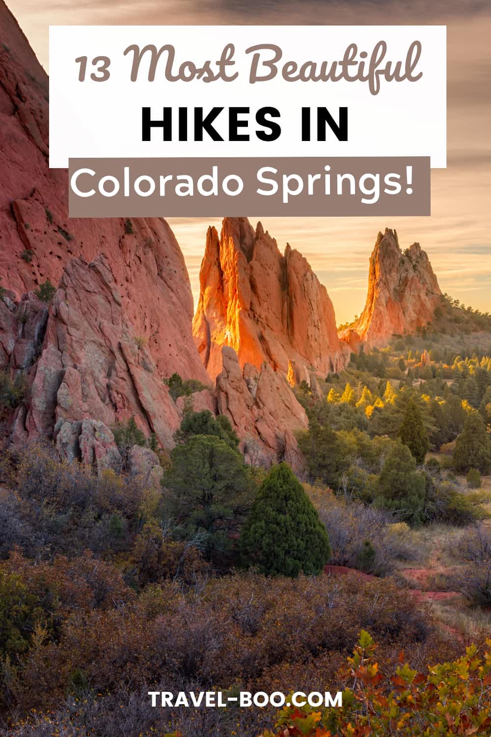
Garden of the Gods has more than 22 miles of trails threading through 300-foot sandstone fins, and the park and its Visitor and Nature Center are both free. More than 4 million people come through each year, which tells you something about the parking situation.
For a first visit, the Perkins Central Garden Trail is the one. It is a paved 1.5-mile loop with less than 30 feet of elevation change, wheelchair and stroller accessible, and it runs directly beneath the tallest formations including Kissing Camels and Cathedral Rock. If you want something with a bit more to it, the Ridge Trail is a half-mile loop with under 100 feet of climbing that puts you among the rocks rather than beneath them, and the Siamese Twins Trail is a 1-mile round trip to a natural rock window that frames Pikes Peak.
Honest assessment: on a summer weekend the Central Garden is genuinely crowded and does not feel like a hike. Come at opening (5 a.m.) or in the last hour before close, or walk the Scotsman and Buckskin Charlie loop instead, which looks back at the formations from a distance with a fraction of the people.
💡 Insider Tip
Skip the Visitor Center parking scramble entirely. The park runs a free shuttle through the summer, roughly 9 a.m. to 5 p.m., departing about every 15 minutes and stopping at the Visitor and Nature Center, the Central Garden, the Overflow Parking Lot and Rock Ledge Ranch. Park in the Overflow lot and ride in. There is also a free self-guided audio tour you can play through your car speakers on the park loop road, and a daily guided nature walk at 10:30 a.m. for $5 with reservations required.
3. Mount Muscoco Trail

Location: North Cheyenne Cañon Park | Distance: ~4.2 miles out and back | Difficulty: Moderate | Elevation gain: ~1,300 ft | Summit: 8,020 ft
Of every trail on this list, this one gives you the best summit view for the effort. Start at the Mount Cutler and Muscoco trailhead on North Cheyenne Canyon Road, follow the Mount Cutler Trail for about half a mile, then take the signed Muscoco branch to the right.
The grade is steady rather than brutal for most of the climb, with a brief flat section crossing the saddle between Cutler and Muscoco. The last half mile is where it gets real: loose scree underfoot, a short scramble near the top and no shade. What you get in return is a genuine 360-degree summit at 8,020 feet, with Colorado Springs and the eastern plains on one side and the Front Range peaks on the other. Most people take around 3 hours round trip.
Older kids who are steady on their feet will manage it. Younger children and anyone nervous on loose ground will find the final stretch unpleasant, particularly on the way down, which is genuinely the steepest part of the day.
💡 Insider Tip
If you are traveling in anything larger than a car, read this first: buses, RVs and oversized vehicles are not permitted on North Cheyenne Canyon Road. Park lower down and walk or bike in. The Mount Cutler and Muscoco trailhead lot is also tiny, so it fills early on weekends. The bigger 92-space lot uphill of Helen Hunt Falls, at the junction of North Cheyenne Canyon Road, High Drive and Gold Camp Road, is the reliable fallback. Storm damage closed both roads through the park in June 2025 and again in June 2026, so check the city’s North Cheyenne Cañon page before you drive up.
4. St. Mary’s Falls
Location: North Cheyenne Canon Park, trailhead at the High Drive and Gold Camp Road junction | Distance: ~6 miles out and back | Difficulty: Moderate | Elevation gain: ~1,180 to 1,390 ft
The Colorado Springs area has a real waterfall, and this is the hike that gets you to it. St. Mary’s Falls, Trail #624, ends at a tall cascade pouring down the granite at the head of Buffalo Canyon. Published heights vary between 250 and 300 feet depending on where you look, but either way it is the biggest thing of its kind within easy reach of the city.
The first mile is the least interesting part: a wide, exposed walk along a closed section of Upper Gold Camp Road, with a short detour around a collapsed railroad tunnel. Push through it. Once the singletrack drops into Buffalo Canyon the trail turns shaded and follows the creek, and you reach the sign for the base of the falls at around 1.7 miles from the trailhead. If you want more, switchbacks continue above the falls toward Mount Rosa.
The half mile before the falls is steep and loose, which is worth knowing before you commit. Dogs are welcome on leash, and the trail is also open to bikes and horses, so it is busier than the mileage suggests.
Best in late spring and early summer, when snowmelt has the falls running hard. By late summer the flow drops noticeably. The parking lot at the end of the paved road is shared with the Seven Bridges trail, which is the same first stretch of trail 622 used on the Loud’s Cabin hike further down this list, so it fills early on weekends.
5. Palmer Trail and Section 16 Loop

Location: Bear Creek Cañon Park, Section 16 trailhead on Gold Camp Road | Distance: 5.7 to 6 miles loop | Difficulty: Moderate | Elevation gain: ~1,290 ft
This is the classic Colorado Springs loop, and the one locals name when you ask what to do with a free morning. It climbs from the Section 16 trailhead on Gold Camp Road through red rock and scrub oak, then into ponderosa forest, with open views back over Red Rock Canyon Open Space and Garden of the Gods for the first stretch.
Almost all of the 1,290 feet of climbing happens in the first 2 miles, through a series of switchbacks. After the high point there is a short detour to an overlook worth taking, then the trail swings around and crosses Hunter Run creek before descending to the High Drive dirt road and back to the trailhead. Plan on 3 to 3.5 hours.
The footing is loose gravel in places and there are some rocky sections, so this is a boots rather than sneakers hike. Signage at the junctions is the main thing people struggle with, since several unmarked trails branch off toward Red Rock Canyon. Follow the Section 16 signs and stay on the more-used uphill path. It is also a popular mountain bike descent, and riders come down Section 16 fast, so keep your ears open.
6. Red Rock Canyon Open Space

Location: Between Colorado Springs and Manitou Springs, south of US 24 | Distance: 1.75 to 5.4 miles depending on trail | Difficulty: Easy to hard | Cost: Free
Red Rock Canyon is the same Fountain Formation sandstone as Garden of the Gods, two miles south, with a fraction of the crowds and none of the tour buses. There are 11 marked trails through parallel red hogback ridges and eroded canyons, plus an old quarry that supplied stone for buildings in Colorado Springs and Denver.
The Contemplative Trail is the standout. It runs close in against the rock, often between two walls, with pine benches installed along the route. Starting from the Sand Canyon trailhead at the west end of the parking lot you can go up one and down the other for a loop of roughly 1.75 miles. For more distance, the Lower Hogback, Red Rock Rim and Red Rock Canyon combination is about 2.5 miles, and swapping in Hogback Valley and Lion Trail makes it 3.3.
Park hours are 5 a.m. to 9 p.m. from November 1 to April 30, and 5 a.m. to 10 p.m. from May 1 to October 31. There are two fenced off-leash dog loops, which makes this the best trail on the list if you are hiking with a dog. Everywhere else in the park, dogs stay leashed.
💡 Insider Tip
The Contemplative Trail is the only hiker-only trail in the park. Bikes and horses are barred from it deliberately, which is exactly why it stays quiet in a park that is otherwise busy with mountain bikers. It was built by a local volunteer group, the Garden of the Goddesses, who wanted one route dedicated to walking. If you have come to Red Rock Canyon for peace rather than mileage, this is where you go.
7. Cheyenne Mountain State Park
Location: 410 JL Ranch Heights Road, Colorado Springs | Distance: 1 to 17+ miles depending on trail | Difficulty: Easy to extreme | Cost: Daily vehicle pass or Colorado State Parks pass
This is the only hike on the list where you can sleep at the trailhead. Cheyenne Mountain State Park covers 2,701 acres on the eastern flank of Cheyenne Mountain, and it has 61 campsites with RV hookups and cabins alongside more than 28 miles of trail. Colorado Parks and Wildlife rates 23 of those miles easy to moderate and the remaining 6.7 miles difficult to extreme, so you can pitch a tent and pick your day from the same parking lot.
The trails climb from prairie grassland through Gambel oak into ponderosa pine and Douglas fir, which is the whole plains-to-peaks transition compressed into a couple of miles. The Talon and Sundance trails carry most of the mid-range routes, with views back over Colorado Springs on one side and the bulk of Cheyenne Mountain on the other.
The serious objective is the Dixon Trail, which is the only route to the top of Cheyenne Mountain and a 17-plus mile round trip. That is a full day and then some. Hikers, bikers and horses can travel it as far as the 2.5-mile mark, which makes a good turnaround if you want the character of the trail without the commitment.
The park opened fully in 2008 on the former JL Ranch and the wildlife reflects how recently it was working land. Mule deer, elk, bobcats, black bears and mountain lions all use it, along with more than 200 bird species. Carry water: the creeks here can dry up by late summer.
💡 Insider Tip
Do not turn up here with a dog and assume you can hike. Unlike almost every other park in this guide, dogs are permitted on only four trails at Cheyenne Mountain State Park: Acorn Alley, Bobcat Way, Raccoon Ridge and a marked section of Soaring Kestrel. Everything else, including Dixon and the Talon trails, is closed to them. There is also no access to any of the dog trails from the Limekiln Trailhead, which is where most people park, so check the map before you choose a lot. Horses have their own rules and are allowed on Dixon, Talon North and Talon South, with Sundance partially open.
8. Paint Mines Interpretive Park

Location: 29950 Paint Mines Road, Calhan | Distance: ~4 miles of trails | Difficulty: Easy | Cost: Free, open dawn to dusk year-round
This one requires a drive of around 40 miles east into the plains, and for the first 20 minutes you will be convinced you are lost. There is nothing out there but grassland. Then a shallow ravine opens up and you are looking at hoodoos and spires banded in pink, orange, yellow and white, formed from exposed layers of selenite clay and jasper.
The 750-acre park has around 4 miles of easy interpretive trails looping through prairie and down into the badlands, with signage covering the geology and the human history. There is evidence of people here going back roughly 9,000 years. Plains Woodland peoples mined the clay for pottery, and in the historic period it was dug for bricks used in buildings in Colorado Springs and Pueblo.
Go on a dry day. The clay turns to slick, ankle-deep mud after rain, and there is no shade anywhere in the park.
💡 Insider Tip
Paint Mines has the strictest rules of anywhere on this list, so read them before you load the car. No dogs at all, no bikes, no horses and no drones. Climbing on the formations or entering them is prohibited, and you must stay on the marked trails, because the washouts look like trails and are not. The park closes at night, but El Paso County issues a permit if you want to shoot astrophotography there. There is a restroom at the main lot but no drinking water, so fill up in Calhan on the way through.
9. Rampart Reservoir and Rainbow Gulch

Location: Pike National Forest, ~4 miles east of Woodland Park | Distance: 3.7 miles out and back on Rainbow Gulch | Difficulty: Easy | Elevation gain: ~280 ft
Rampart is a 500-acre reservoir sitting at close to 9,000 feet on the north slope of Pikes Peak, ringed by pine and spruce. Rainbow Gulch Trail #714 is the shortest and gentlest way in, dropping about 1.4 miles down an old road bed through aspen and pine to the northwest shoreline. House-sized boulders line parts of the route, and the reservoir opens up in front of you with the mountains beyond.
This is the best easy hike on the list in terms of scenery-per-mile, and the least demanding way to get real alpine views without a climb. Families walk down for a picnic, anglers carry float tubes to the coves and it is a popular dog-friendly trail with leashes required. If you want more, the Rampart Reservoir Trail #700 circles the whole reservoir for roughly 12 to 14 miles.
Fall is the standout season, when the aspen groves turn. In winter, once the snow settles in, it becomes a snowshoe route. Swimming and water contact are not allowed at any time of year.
💡 Insider Tip
Driving into the Rampart Reservoir Recreation Area costs a $10 day-use fee per vehicle. Hiking in on Rainbow Gulch Trail #714 is free, because the trailhead sits outside the fee area on Rampart Range Road. Rainbow Gulch is also the winter access route: Rampart Range Road and Forest Service Road 306 are gated shut from around December through April, and the trail is how you reach the water in those months. Drinking water is available at the Promontory Picnic Area in summer only, so carry your own the rest of the year.
10. Loud’s Cabin
Location: North Cheyenne Cañon Park, Gold Camp parking lot | Distance: ~6.5 miles out and back | Difficulty: Moderate | Elevation gain: ~1,770 ft
One of the longer day hikes near Colorado Springs, and the one with a story at the end of it. Loud’s Cabin, also known as Chipmunk Lodge, was built in 1902 by Frank Herbert Loud, the first head of the mathematics department at Colorado College. What remains today is mostly a large stone chimney standing in the trees on the southern slope of Mount Garfield.
The route starts from the Gold Camp parking lot, follows Gold Camp Road to a metal gate, joins the Seven Bridges Trail #622 along North Cheyenne Creek, continues past the seventh bridge and around Mount Kineo, then picks up the Loud’s Cabin Trail #622A for the final half mile. Expect around 4 hours. Dogs are welcome on leash.
Watch your navigation. This is a busy junction of trails and it is easy to end up somewhere else entirely. Stick to the 622A markings for the last section, and treat the cabin remains as the historic structure they are. Do not move or take anything from the site.
One important note on maps: the Bear Creek watershed here holds the only known genetically pure, naturally reproducing population of greenback cutthroat trout, Colorado’s state fish, in about a 4-mile stretch of creek. Trail 666 along Bear Creek was decommissioned and remains closed for habitat reclamation, and Captain Jacks was rerouted in 2017. Any map or guidebook older than about 2016 will send you somewhere that no longer exists.
11. Pulpit Rock

Location: Austin Bluffs Open Space, 6411 N Nevada Ave | Distance: ~2 mile loop, up to 5.1 miles | Difficulty: Easy to moderate | Summit: 6,621 ft
This is the one you can do on a weekday evening. Pulpit Rock is the pale outcrop you see from Interstate 25 north of downtown, and the summit sits inside the city at 6,621 feet. The standard loop from the Pulpit Rock parking lot on North Nevada Avenue runs about 2 miles with roughly 265 to 300 feet of climbing, and the wider Austin Bluffs Open Space holds about 10 miles of trail across 584 acres if you want to string a longer route together.
The rock itself is Dawson Arkose, a sandstone and mudstone formation laid down as the Rockies rose roughly 66 million years ago. From the top you get Pikes Peak, the Front Range and the whole city laid out below, which is a lot of view for a hike that starts in a parking lot off a main road. Juniper and pine grow straight out of the rock along the way.
Two practical things. The trails here are poorly signed and there are informal paths running everywhere, so download an offline map before you set off. And because several sections sit in permanent shade under the outcrops, ice lingers there long after the rest of the city has thawed. Take the longer, gentler route in winter rather than the steep scramble.
12. Centennial Trail
Location: Woodland Park to Manitou Lake Recreation Area, Pike National Forest | Distance: 14.8 miles out and back | Difficulty: Moderate | Elevation gain: ~800 ft
A wide paved trail running north from Woodland Park alongside State Highway 67 to the Manitou Lake Recreation Area. It begins in the open next to the road and then works its way into the woods, with distant mountain views for most of the way and gentle grades throughout.
From May to October the scenery does most of the work: wildflowers through summer, then aspen color from late September. You can break the walk at the lakeside campground, and plenty of people ride it rather than walk it, which is arguably the better use of a paved 14.8-mile round trip.
Be realistic about what this is. It parallels a state highway, so it is a cruise rather than a wilderness experience, and it is not a loop. The return leg climbs steadily the whole way, which is the part that catches people out after a pleasant downhill outbound. To reach the trailhead, take US 24 west to Woodland Park, turn north on Highway 67 and follow the signs.
13. Midland Trail
Location: America the Beautiful Park, downtown Colorado Springs, to Manitou Springs | Distance: ~5 miles one way | Difficulty: Easy | Elevation gain: ~300 ft
The Midland Trail is a concrete path following Fountain Creek west from America the Beautiful Park in downtown Colorado Springs, through Old Colorado City, out to Manitou Springs. It crosses the creek on a series of bridges, has picnic tables and benches along the way, and the paved sections are wheelchair and stroller friendly.
It is genuinely useful as a connector. From the downtown end it links to the Pikes Peak Greenway and the US Olympic and Paralympic Museum. At the western end you come out near Red Rock Canyon Open Space, so you can walk or ride from downtown and start a real hike without moving your car.
Two things to know. The trail is built in sections with a gap between 21st and 25th Streets, where you are routed onto Naegele Road, a quiet street, before rejoining. And it runs alongside US 24 for much of its length, so treat it as a city walk with mountain views rather than a nature trail. Pedestrian signals handle the busier crossings at 31st and 8th Streets.
Worth flagging if you are bringing children specifically for the fountain: the Julie Penrose Fountain at America the Beautiful Park is not operating during the 2026 season as part of the city’s parks budget adjustments. The playground and lawns are open as normal.
Where To Stay For Hiking In Colorado Springs
Where you base yourself makes a real difference here, because the trailheads are spread across three separate directions from the city.
- Manitou Springs puts you within walking distance of the Manitou Incline shuttle, Barr Trail and the Midland Trail’s western end, with Red Rock Canyon a short hop away. Best choice if the Incline is your main objective.
- Old Colorado City and the west side is the most central option, close to Garden of the Gods, Red Rock Canyon, the Section 16 trailhead and North Cheyenne Cañon, with more places to eat afterward.
- Woodland Park, up US 24 west of the city, is the base for Rampart Reservoir and the Centennial Trail, and it sits higher and cooler than Colorado Springs in midsummer.
Plan Your Trip
Compare stays across Manitou Springs, Old Colorado City and Woodland Park on one map, so you can see how far each option really is from the trailheads (affiliate link):
Colorado Springs Hiking FAQs
Do you need a reservation to hike the Manitou Incline?
Yes. Every hiker needs a free online reservation and a signed waiver, and a new waiver is required each time you go, even if you have climbed it before. Reservations are made through the City of Colorado Springs and open on the 1st of each month for the current and following month. Groups are capped at 8 people. Dogs and strollers are not allowed, and you cannot descend the Incline itself, so plan on coming down Barr Trail.
What is the easiest hike in Colorado Springs?
The Perkins Central Garden Trail at Garden of the Gods: a paved 1.5-mile loop with less than 30 feet of elevation change, accessible for wheelchairs and strollers, running right beneath the biggest rock formations. If you want an easy hike with mountain rather than city scenery, take Rainbow Gulch Trail down to Rampart Reservoir instead. It is 3.7 miles out and back with about 280 feet of gain.
Are dogs allowed on Colorado Springs hiking trails?
On most of them, yes, on a leash. Three exceptions on this list. The Manitou Incline bans dogs completely. Paint Mines Interpretive Park bans dogs, bikes and horses to protect the fragile clay formations. And Cheyenne Mountain State Park allows dogs on only four of its trails, with no access to any of them from the Limekiln Trailhead. Red Rock Canyon Open Space is the most dog-friendly option here, with two fenced off-leash loops in addition to its leashed trails.
Do you have to pay to hike in Colorado Springs?
Mostly no. Garden of the Gods, Red Rock Canyon Open Space, North Cheyenne Cañon Park, Paint Mines and Austin Bluffs are all free to enter. The Manitou Incline is free to hike but requires a reservation, and you will pay for parking. Driving into the Rampart Reservoir Recreation Area costs a $10 day-use fee per vehicle, though hiking in on Rainbow Gulch Trail is free. Cheyenne Mountain State Park requires a daily vehicle pass or a Colorado State Parks pass.
When is the best time to hike in Colorado Springs?
September and October, for cooler temperatures, aspen color and the end of the summer storm season. July through September is monsoon season, when afternoon thunderstorms are close to a daily event, so start early and be off exposed summits by early afternoon. Lower foothill trails are hikeable year-round with microspikes, but Rampart Range Road is gated from around December through April. If you are coming for St. Mary’s Falls specifically, late spring and early summer is when snowmelt has it running hardest.
How do you handle the altitude when hiking in Colorado Springs?
Colorado Springs sits at 6,035 feet and several of these trails climb above 8,000 feet. Visit Colorado Springs recommends staying below 7,000 feet on your first day and saving the Manitou Incline until you have adjusted. Drink more water than you think you need, take the first day easy, and expect to move slower than you would at home.
Making It Part Of A Bigger Trip
Colorado Springs works well as a few days rather than a week. Once you have done the Incline, Muscoco and Section 16, you have covered the range of what the area offers, and the drive times start getting long.
If the loose scree and thin air here have you thinking about somewhere greener for the next trip, the southern Appalachians are the obvious contrast: shorter climbs, more shade and waterfalls at the end of most of them. The best hikes in Boone NC are the pick of that region for a long weekend. Further north, the best hikes in Upstate New York deliver the Adirondack and Hudson Valley versions of the same idea, including a few rock scrambles that will feel familiar after Muscoco.